Hunter Access
In-Progress Projects
Saltery Cove Trail System Improvements — Kodiak Island
Coordinates: 57.510692, -152.733557
Game Management Unit: 8
Land Manager: Department of Natural Resources (DNR); Division of Mining, Land, and Water*
Description
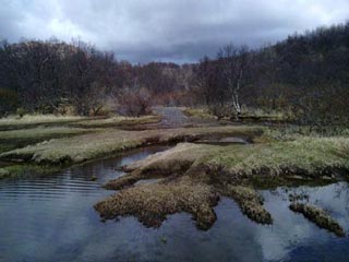
Traversing drainages north of Ugak Bay, the Saltery Cove Trails provide motorized access to habitat ranging from low wetlands to exposed alpine ridgelines. Trail users set out southwest from Chiniak Highway along the American River into the mountains. After descending the pass, heading west at the fork goes to Saltery Lake, while choosing east leads to Lake Miam.
These trails receive considerable use within the Kodiak Island Borough- they provide ample backcountry harvest opportunities for deer, bear, goat and even salmon within Unit 8 that would otherwise be too challenging to reach.
In addition to ADF&G's Hunter Access Program, this project is a collaboration between Alaska Trails Network, Kodiak Island Borough, and Alaska DNR.


Purpose
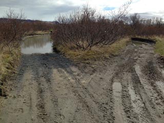
Sections of the Saltery Cove Trail system have degraded with use over time, resulting in trail users bypassing these stretches by creating additional braids along the trail. Motorized users risk habitat degradation and flooding ATV/OHVs along multiple anadromous stream crossings which lack sustainable, reinforced driving surfaces. This project seeks to alleviate these issues by establishing a durable surface along vulnerable or compromised stretches of the trail and creating sustainable stream crossing locations. A necessary easement will also be surveyed and established to ensure long-term public access.
Project Partners
Saltery Cove Trail System Location*
*The majority of the Saltery Cove Trail system sits on public land, but please note that a small portion crosses private land.
