Ice Seal Tracking Maps Archive
02/42/2018 – 02/51/2018

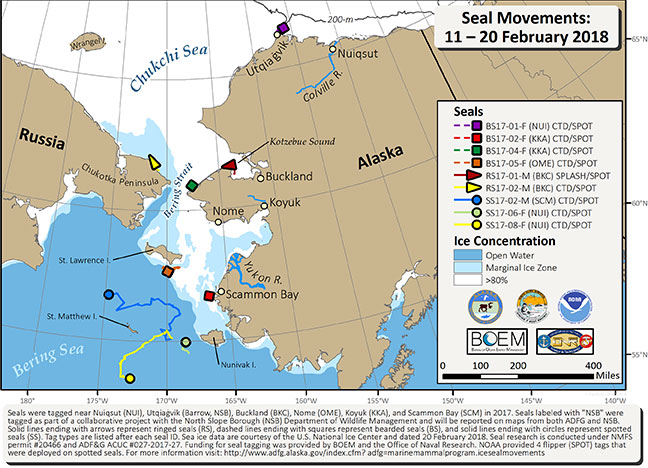
During the last 10 days we have received locations for 4 bearded, 2 ringed, and 3 spotted seals. All ringed and bearded seals are within 15 miles (km) of land while the spotted seals, which were located in the marginal ice zone (<80% ice concentration) between St. Matthew and Nunivak islands, have dispersed in different directions in the open water of the Bering Sea. Strong southerly winds have pushed the sea ice north and exposed open water. Sea ice data are courtesy of the U.S. National Ice Center, dated February 20 (http://www.natice.noaa.gov/products/daily_products.html).
