Ice Seal Tracking Maps Archive
09/251/2020 – 09/265/2020

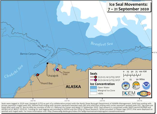
From 7 to 21 September 2020, we received locations for 2 spotted seals. Both spotted seals were hauled out and resting on land; SS19-01-M (red circle) was in Peard Bay and SS19-04-M (pink circle) was in Dease Inlet.
These seals were tagged during the fall of 2019. As expected, the primary tags we epoxied to their backs have since fallen off during the annual molt this spring. The locations we are currently receiving are from the SPOT tags we attached to their flippers. Because SPOT tags are attached to their flippers we only receive locations when the seal has hauled out of the water, either on sea ice or land. Sea ice data are courtesy of the U.S. National Ice Center, dated 21 September 2020 (http://www.natice.noaa.gov/products/daily_products.html).
These seals were tagged during the fall of 2019. As expected, the primary tags we epoxied to their backs have since fallen off during the annual molt this spring. The locations we are currently receiving are from the SPOT tags we attached to their flippers. Because SPOT tags are attached to their flippers we only receive locations when the seal has hauled out of the water, either on sea ice or land. Sea ice data are courtesy of the U.S. National Ice Center, dated 21 September 2020 (http://www.natice.noaa.gov/products/daily_products.html).
